

A while back, a fan, Jake Pitcher, thought a mileage map would be helpful, and posted a Google Sheet of distances.
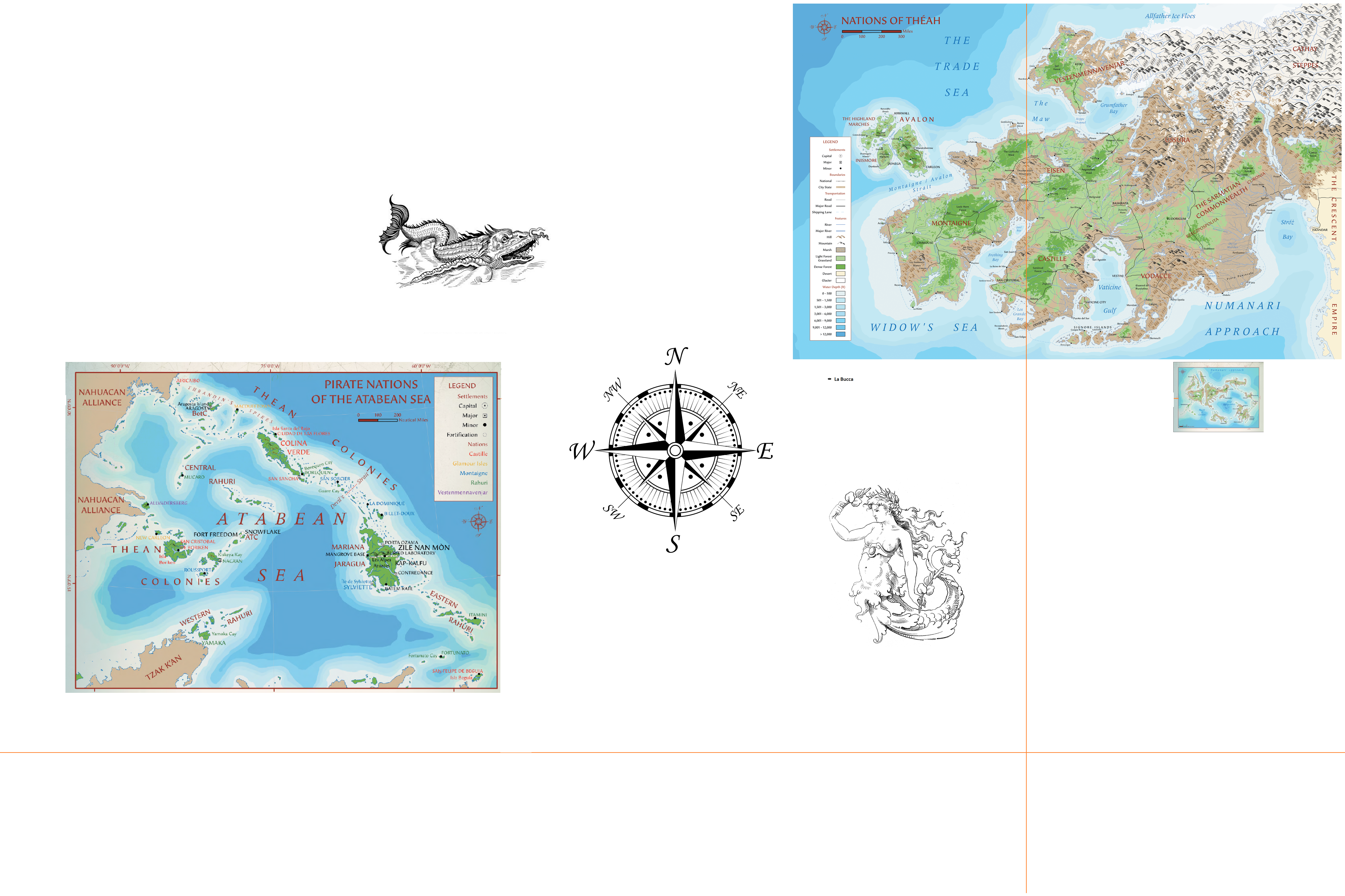
And recently, another fan, Joachim Deneuve du Surlign. has produced an interesting "world" map here.
This new map contains longitude and latitude and even best guesses of the relative positions of the 7th Sea geographic regions explored so far.
WARNING: There be monsters in some unexplored regions. So set sail and uncover those mysteries.
(click map for a high resolution version)
—
TAJ-07: Technopriest And Justicar Of 7thSea2e


To add a bit of commentary to this:
Here is a sneak peak from the 7th Sea cartographer himself, Mark Richardson
This includes the (left to right) Aztlan, our Theah, Crescent Empire and Ifri (faux-Africa below).
TAJ-07: Technopriest And Justicar Of 7thSea2e
That is cool.
Also, Ifri is really close, which makes sense, since the Mediterranean isn't that big. I also guess that the Crescent Empire map is a bit squint.
So on the Ifri map we have...
Khemet (Egypt)
Maghreb (... the Maghreb)
Mbey (I'm finding Gabon and Congo results, so I'm guessing Kingdom of the Kongo)
Manden (Mali Empire)
Aksum (Ethiopia)
I can't make out the writing on the island at the center of the convergence of the rivers (is that the not Niger and the not Nile... so mythic level "source of the Nile"/Mountain of the Moon local) or at the bottom of the map. I wonder if there will be a Mutapa/Zimbabwe based nation, or Swahili Coast/Azania, etc...
Jerry Grayson mentioned a West African analog and the first ever cover preview showed a chief influenced by real-Ghana (once named as The Gold Coast nation).
TAJ-07: Technopriest And Justicar Of 7thSea2e
Actually Manden may be primarily Ghana inspired, that would make sense. I think I assumed it was Mali Empire based because the description we've read of Djen makes it sound like Timbuktu.
You were right : Ifri may be a not-africa but Manden is an actual langage and ethnicity (and also the other name of Mali empire).
And Djen name is close of Djenne https://en.wikipedia.org/wiki/Great_Mosque_of_Djenn%C3%A9
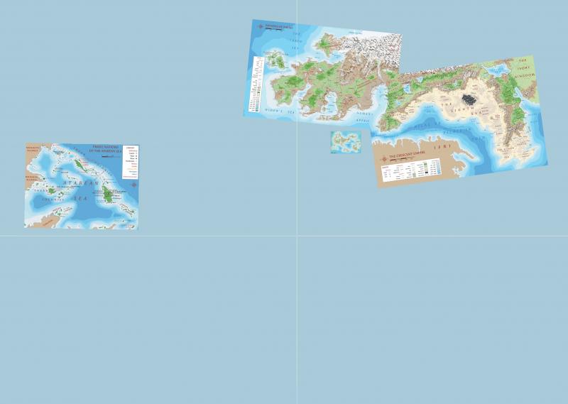
I'm trying to do an edit of this map by myself, to include Cresent Empire map. The mile scale helps but there are some issues :
First, if the North on bove map are respected, the coast doesn't match. So I choose to supperpose the coast and don't care too much of North.
Second, the Attaban archipelago map is clearly not a flat projection, the meridians are incurved and the space between meridian 60, 75 and 90 is not constant (and not the same of the map of Numa). So maybe it's also the case of Crescent and Thea, maybe not.
I've also a question about the Zero Meridian. I don't remember to read anythink on that in the books (maybe I skip it) and so I think it should be placed between pole and some place of importance in history of navigation or geography : Carleon, Vesten or maybe Castillian City. So I don't understand it place in the map below. According to the lattitude on Numa's map and its relative position between Crescent and Thea (deduced by it's position on the Ifri Map, north of Ifri and south to Vodacce), the 0 meridian in this first map of the world is more likely 10E' and 0 meridian pass in Montaigne in the Mt Doré (... but it's hard to tell were exactly as we don't know if this is a 'flat' projection or a deformed projection, as for the Attaban)...
So here's the map I've got. The position of Numa and Attaban archipelago will be certainly be modified when maps of Ifri and Aztlan will be published...
I am hoping we will get the Khitai map.
I do love how Terra is shaping up. We have;
Plus whatever they name the "Colonies" continent. But we have continents! A literal world to explore.
Is The Crescent part of Theah, part of Khitai or its own place, in your opinion.
Isn't that like asking if the Middle East is part of Europe? Asia? Or Russia?
The Crescent Empire belong to the 7th sea system, as Thea, but it is not Thea (as Atzlan, Ifri, Ataban, etc.)